Highway to a new photo location
So you’re looking for some urban exploring locations in the north of the Netherlands? A shame enough, there are not many urbex locations known around here. But I did manage to find these abandoned bunkers though.
One day I was driving over the highway between Marum and Drachten, when I saw some small strange looking buildings in the countryside to my right. Covered by some trees, they seemed to be bunkers. Next day I packed my bag with my camera, got on my bike, and set off to see what these buildings were about.
On the map below, you can see it is actually really close to the highway.
Bunkers
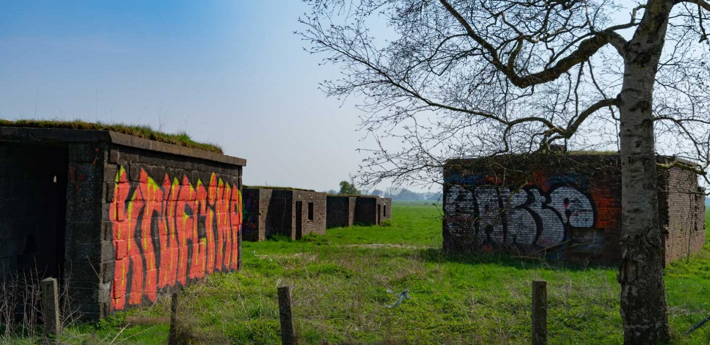
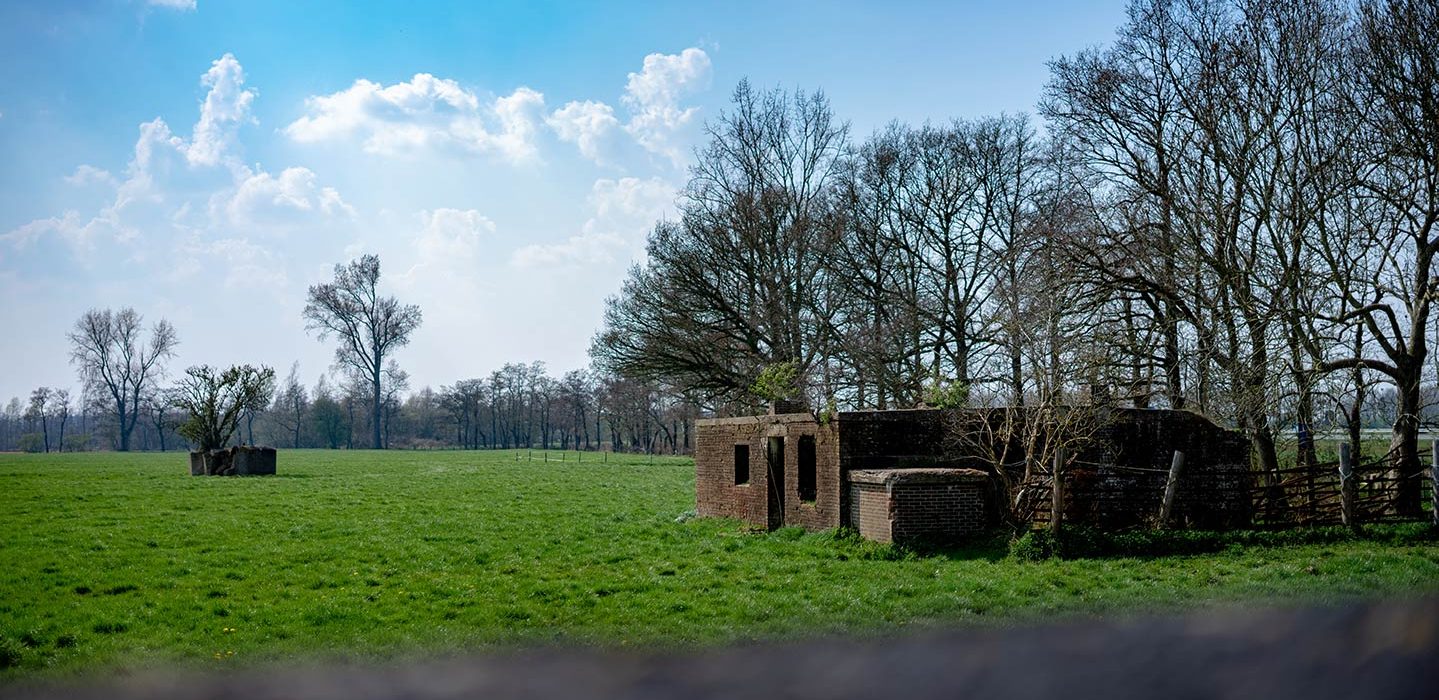
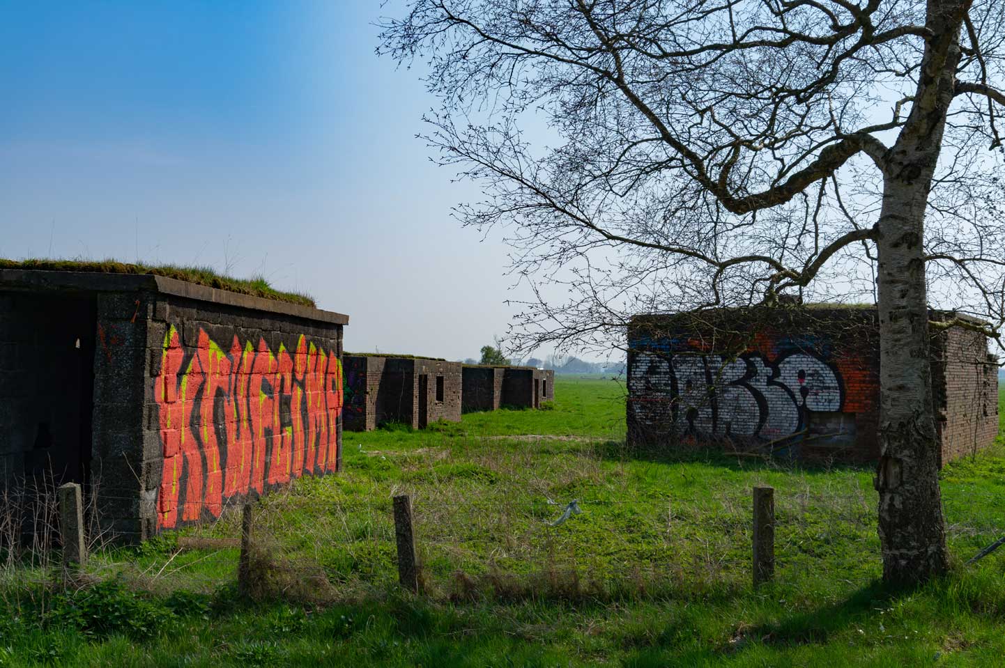
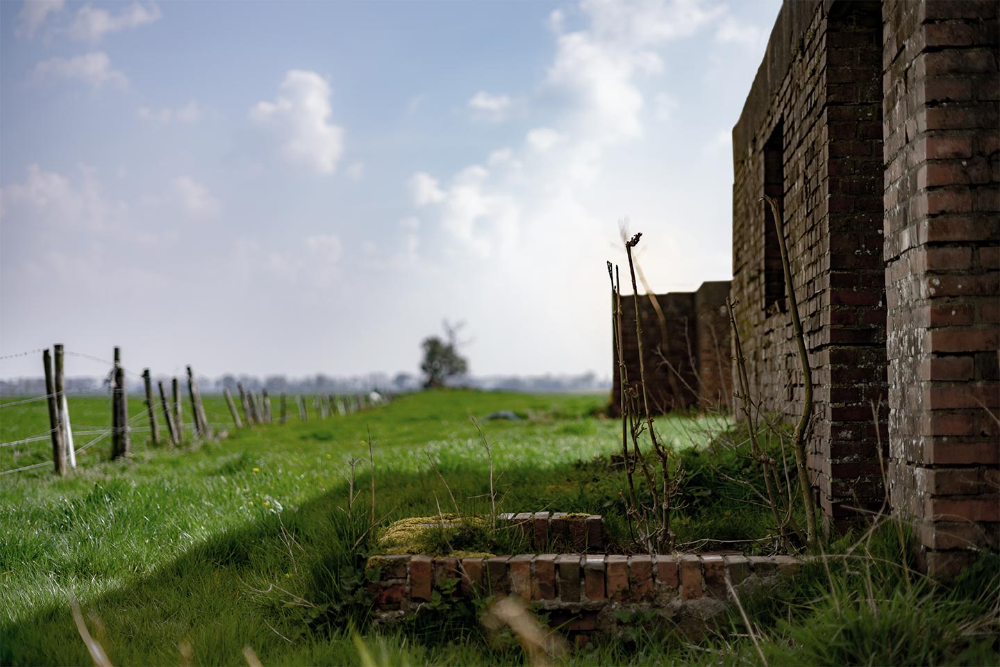
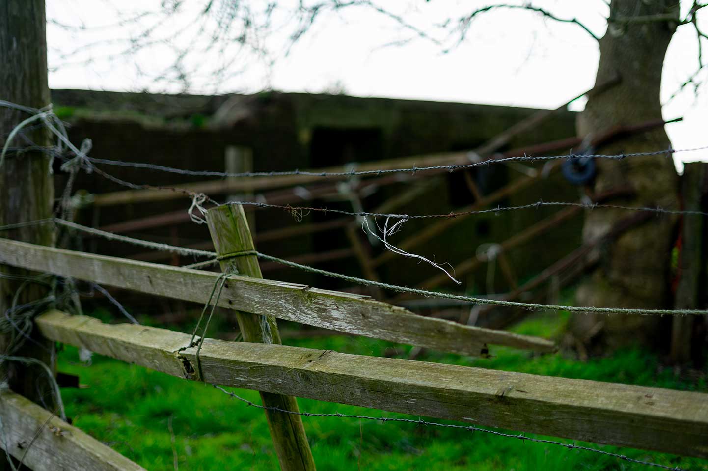
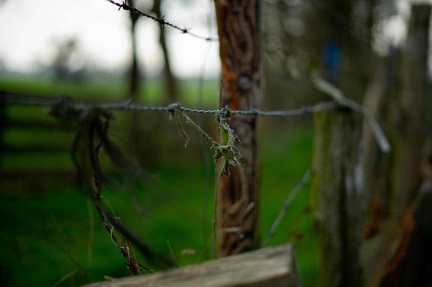
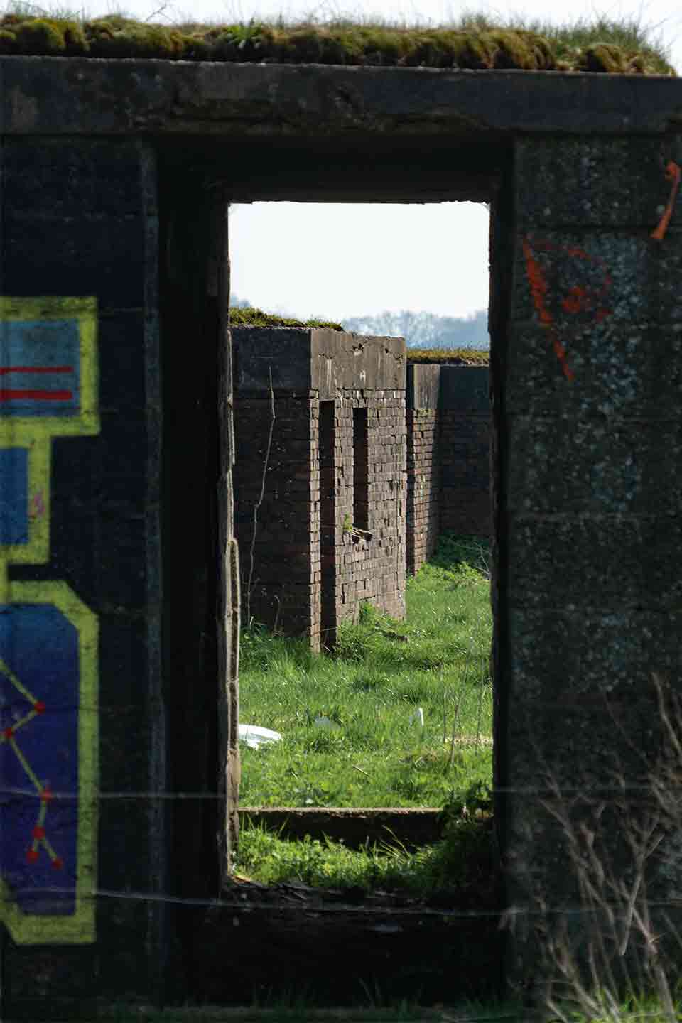
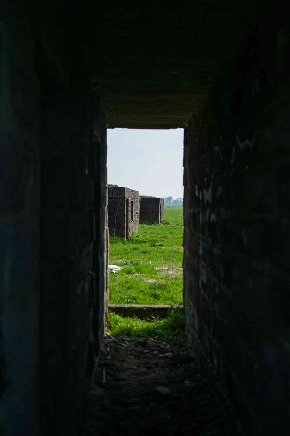
The journey to the location was a really nice trip, with some quiet and peaceful scenery. The bunkers were right next to a narrow road with a dead end. The road ended just before the bunkers.
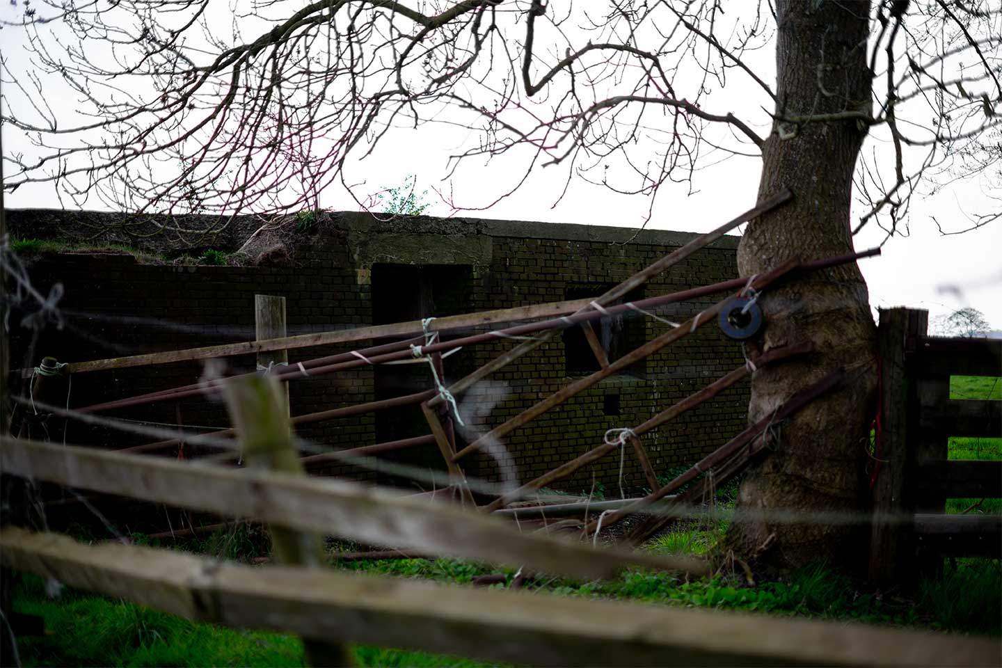
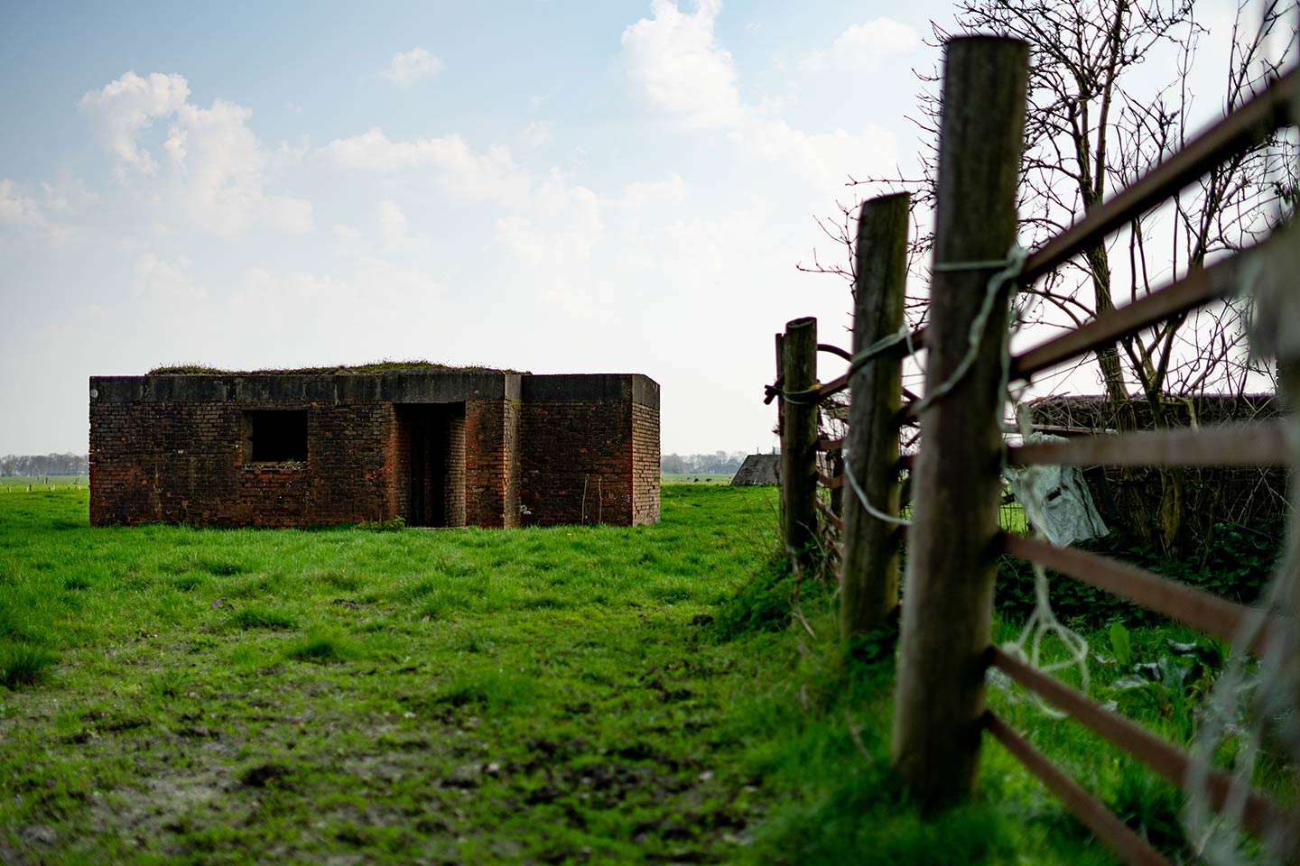
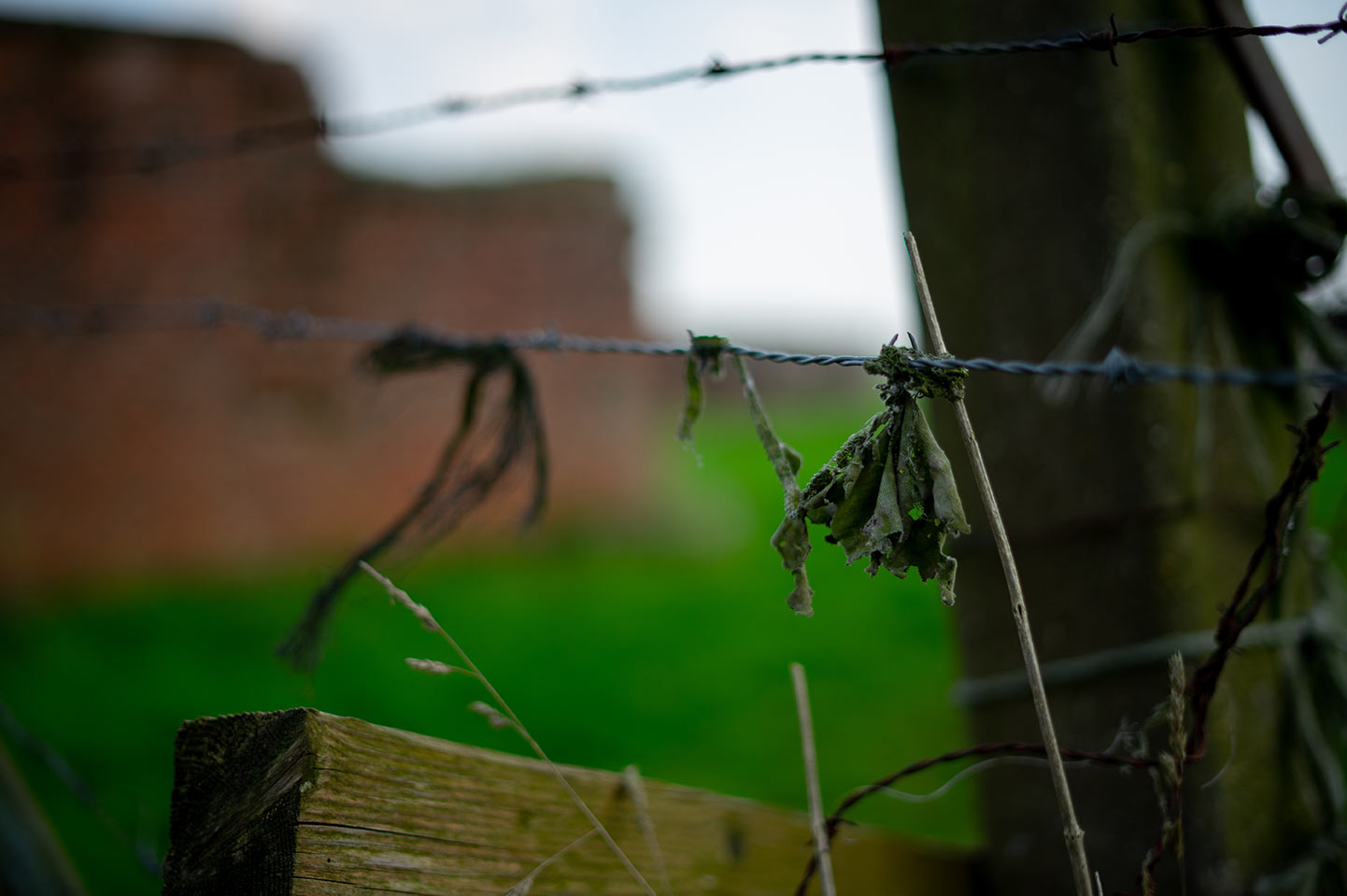
All around the bunkers are miles of countryside. The only thing between me and the bunkers was a bit of barbed wire fence ending at a locked farm gate. Well, if there’s nothing more than a farm gate holding me back from getting to the bunkers, you’re just asking for me to climb over it. So I did, Hahaha.
A brief history
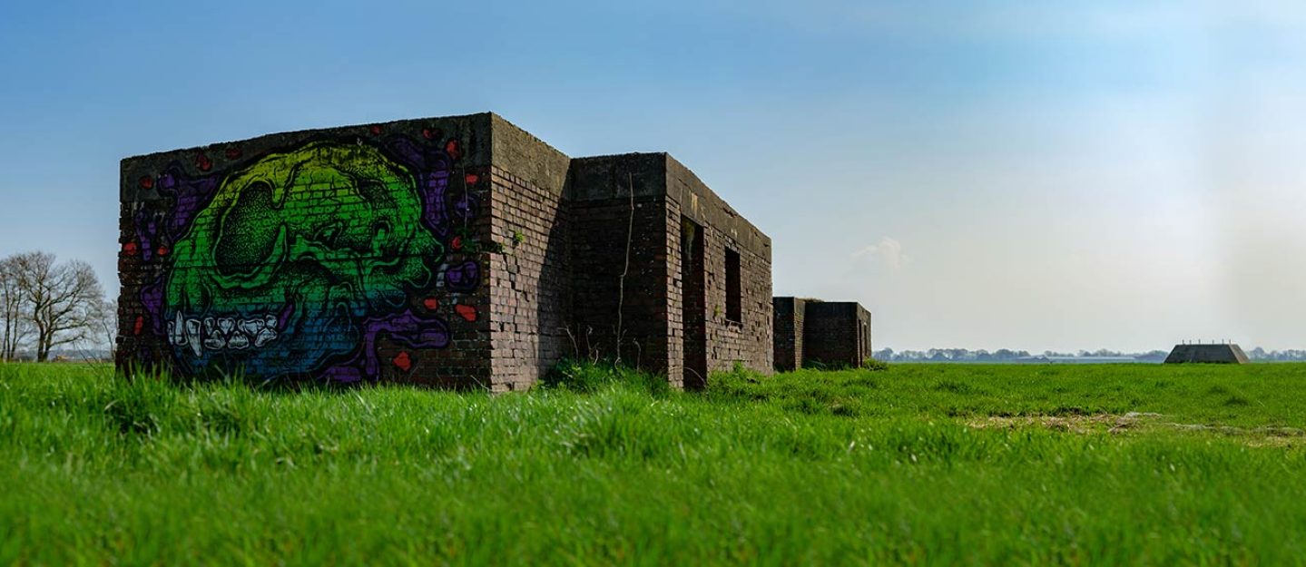
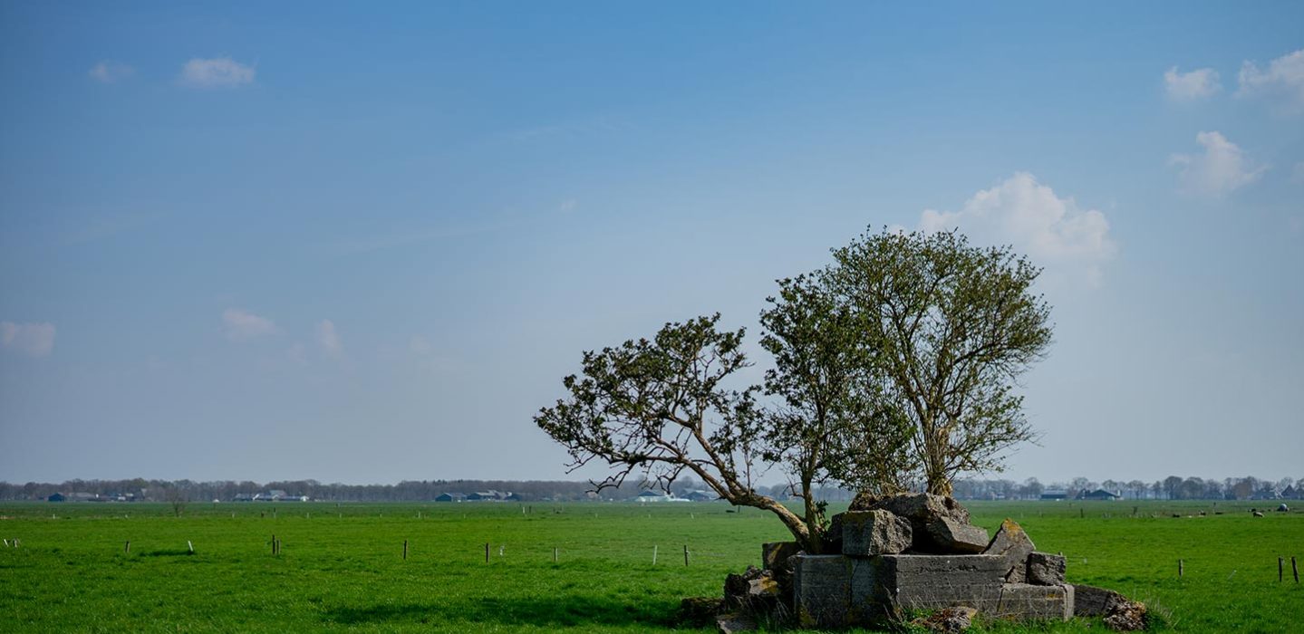
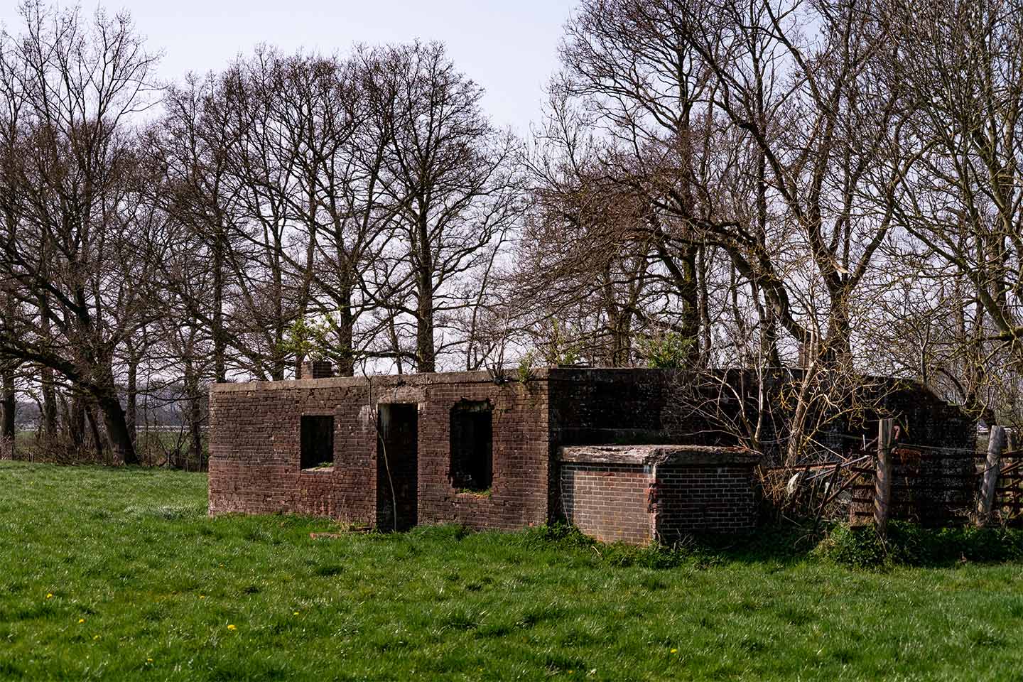
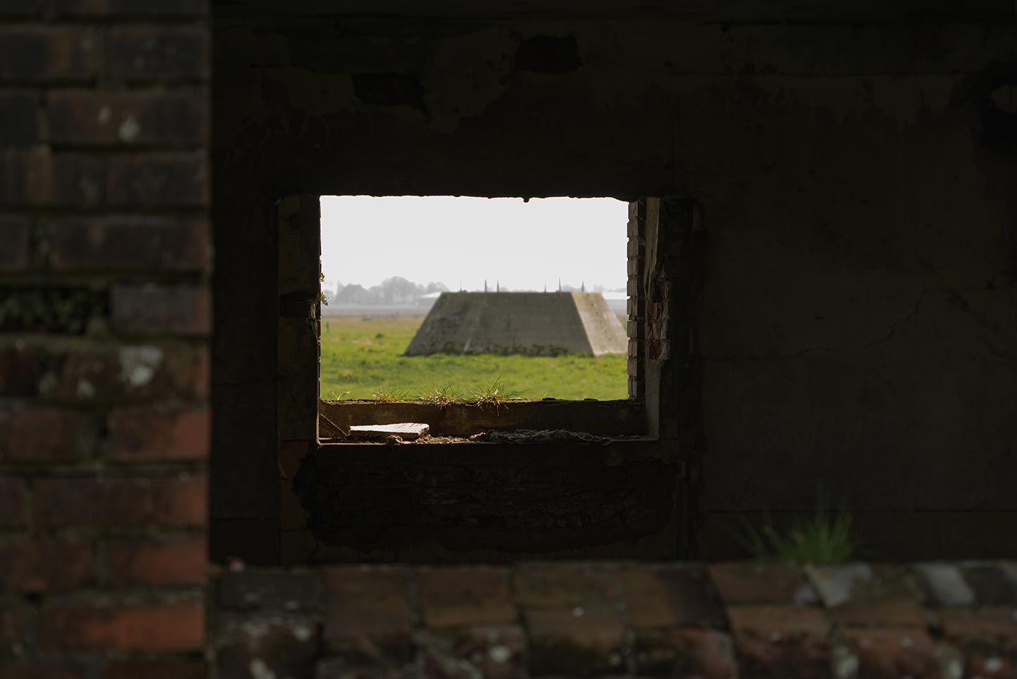
These bunkers are ruins from an old German radar station called “Anlage Löwe”, build during World War II. These bunkers are also known as the “Bunkers at Trimunt”. In the middle of the field is still the foundation of where the radar used to stand (see photo below). This radar was known as a “Würzburg-Riese radar”.
This radar station was part of the “Himmelbett stellung”, which guarded the airspace of Western Europe.
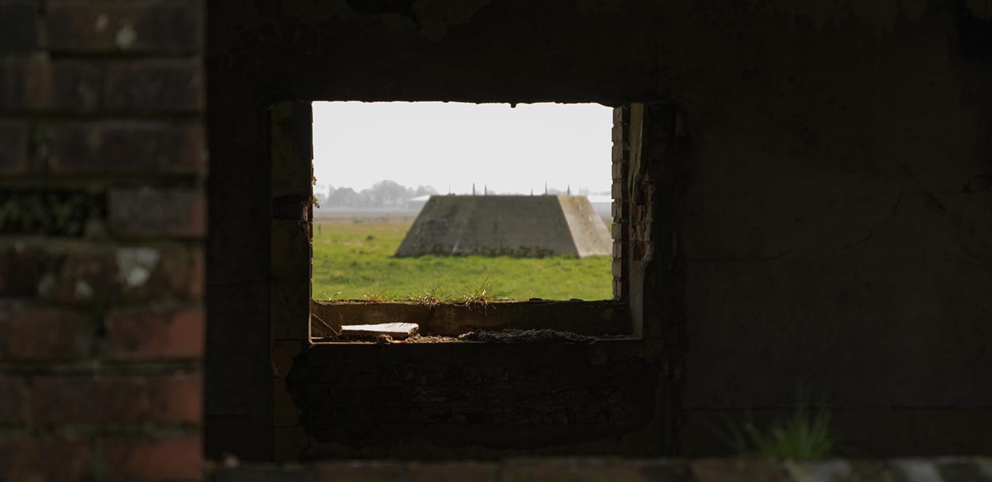
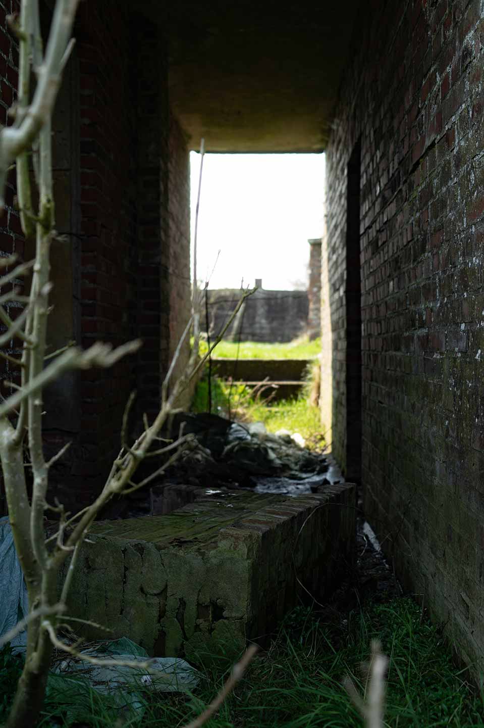
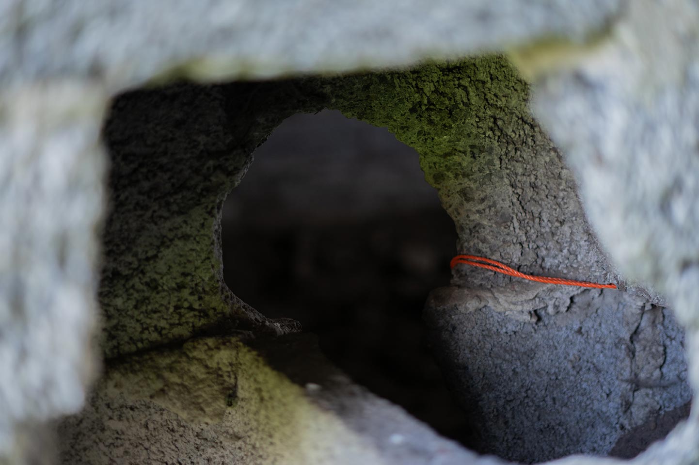
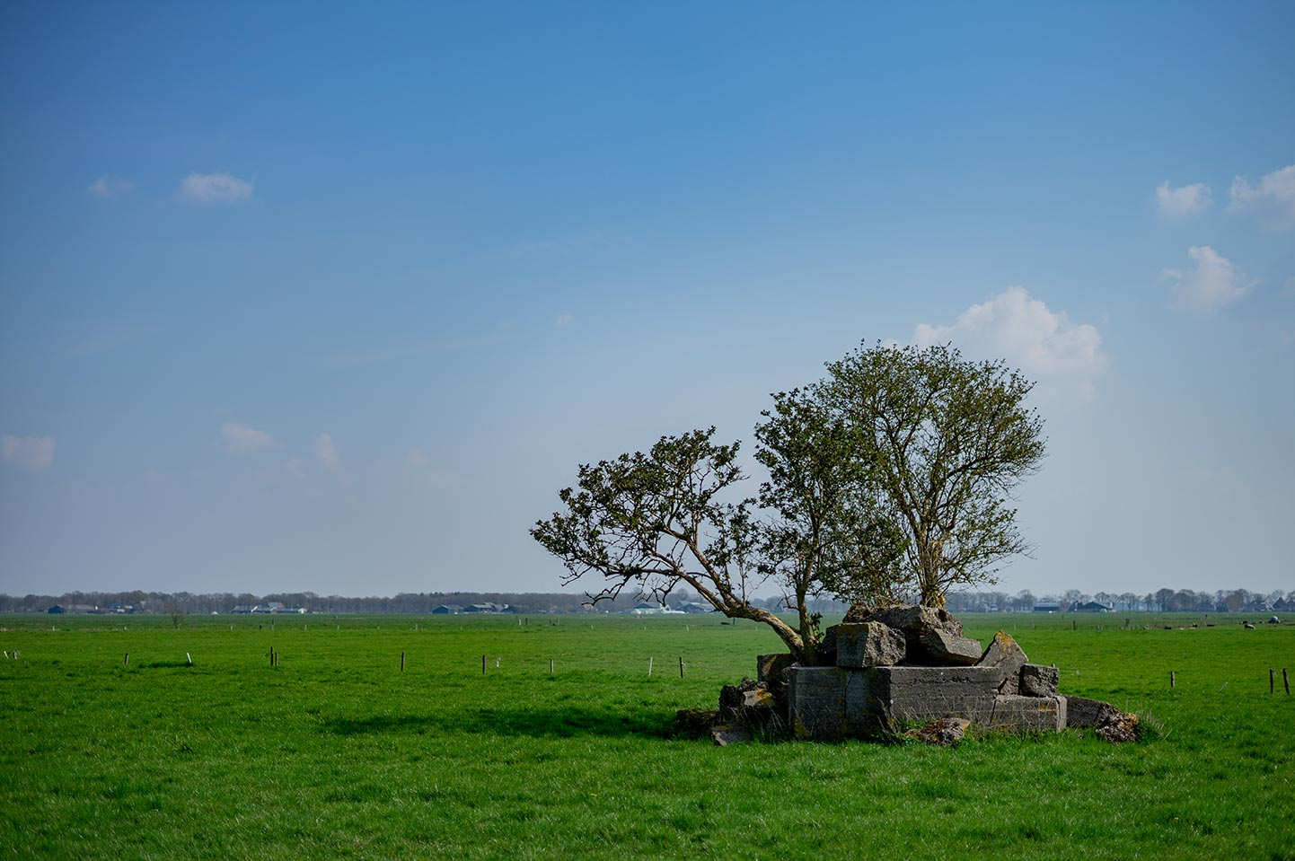
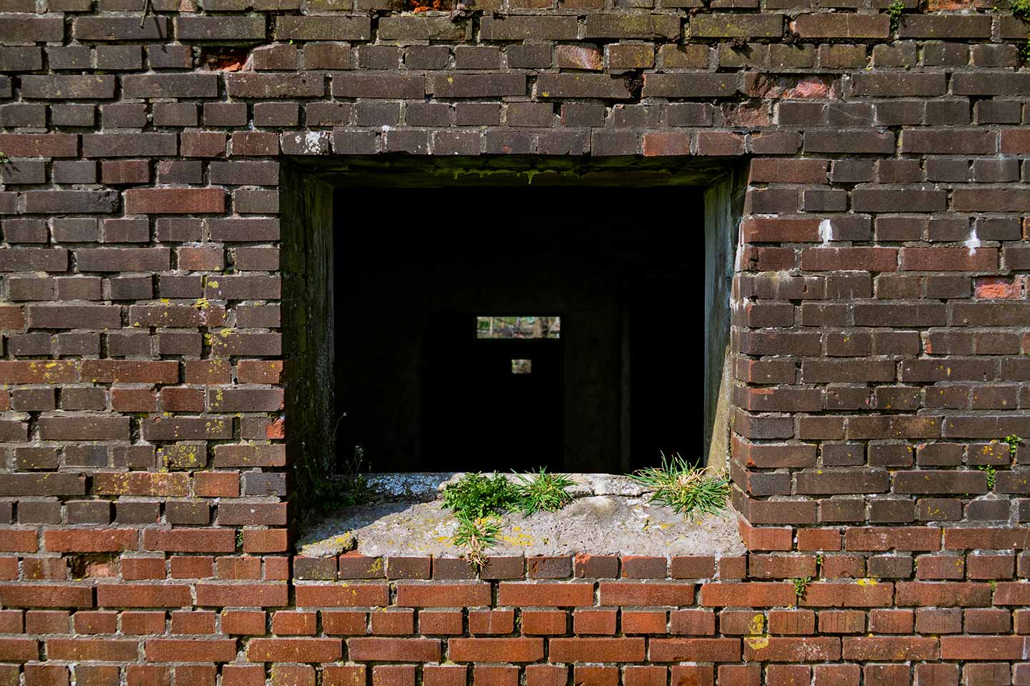
Around the base, where the radar used to stand, are the remains of Tobruks. At the time I had no idea what these things were. They looked like small bunkers which were blown up and someone decided to plant trees in them. These small bunkers were actually used as observation points, often equipped with a machine gun. In the photo below you can see one of the three Tobruks that stood around the radar.
My photographic journey around the bunkers
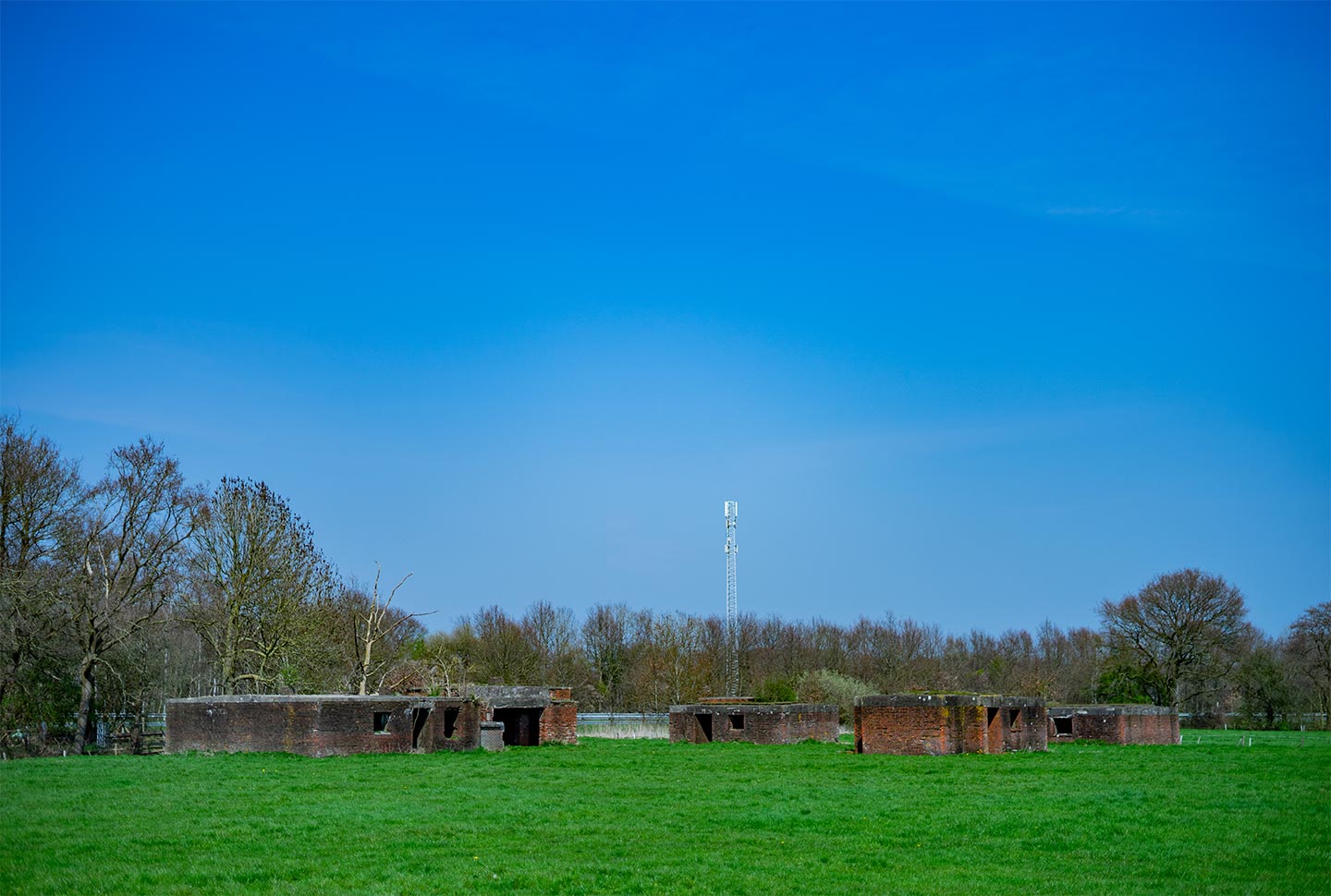
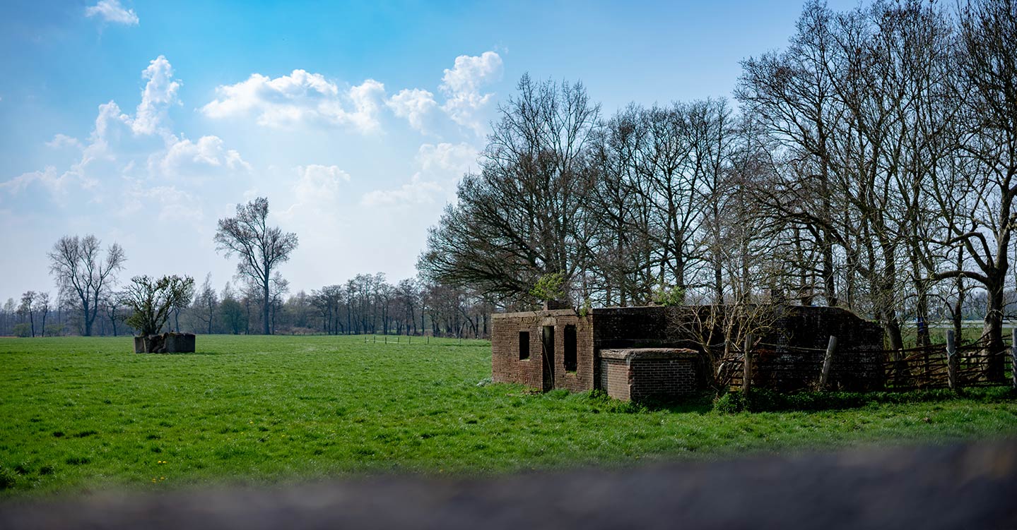
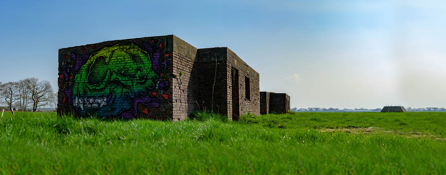
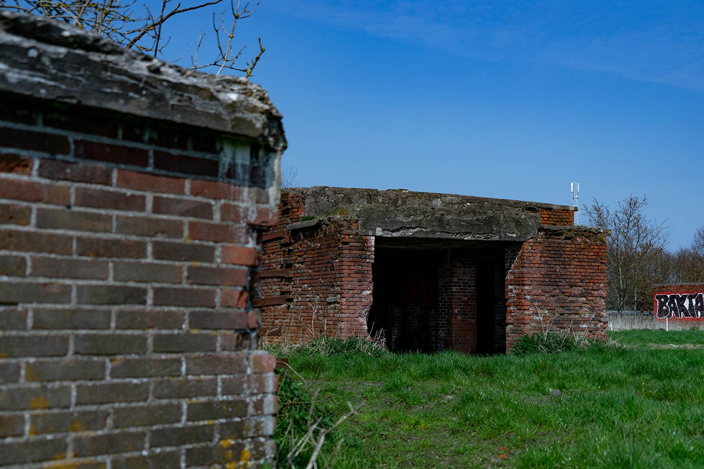
As you can see in the picture below, the sky was beautiful while I was photographing in the countryside. What you might also notice, is that I have taken the photo from the top of another bunker. The bunkers were partially sunken into the ground. So, with a bit of effort, you could actually manage to climb on top of them. Only, while I was trying to climb on top of one, I might have ripped my jeans from knee to crotch. After shooting some photos at the bunkers, I wanted to go to another location to shoot some more photos, but now I would only need to do this with ripped jeans. But hey, that’s fashion nowadays right? XD
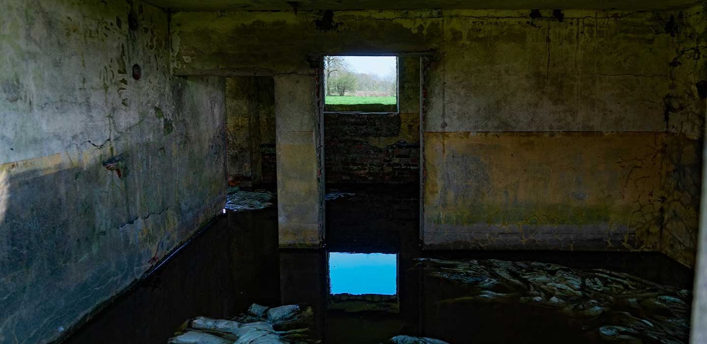
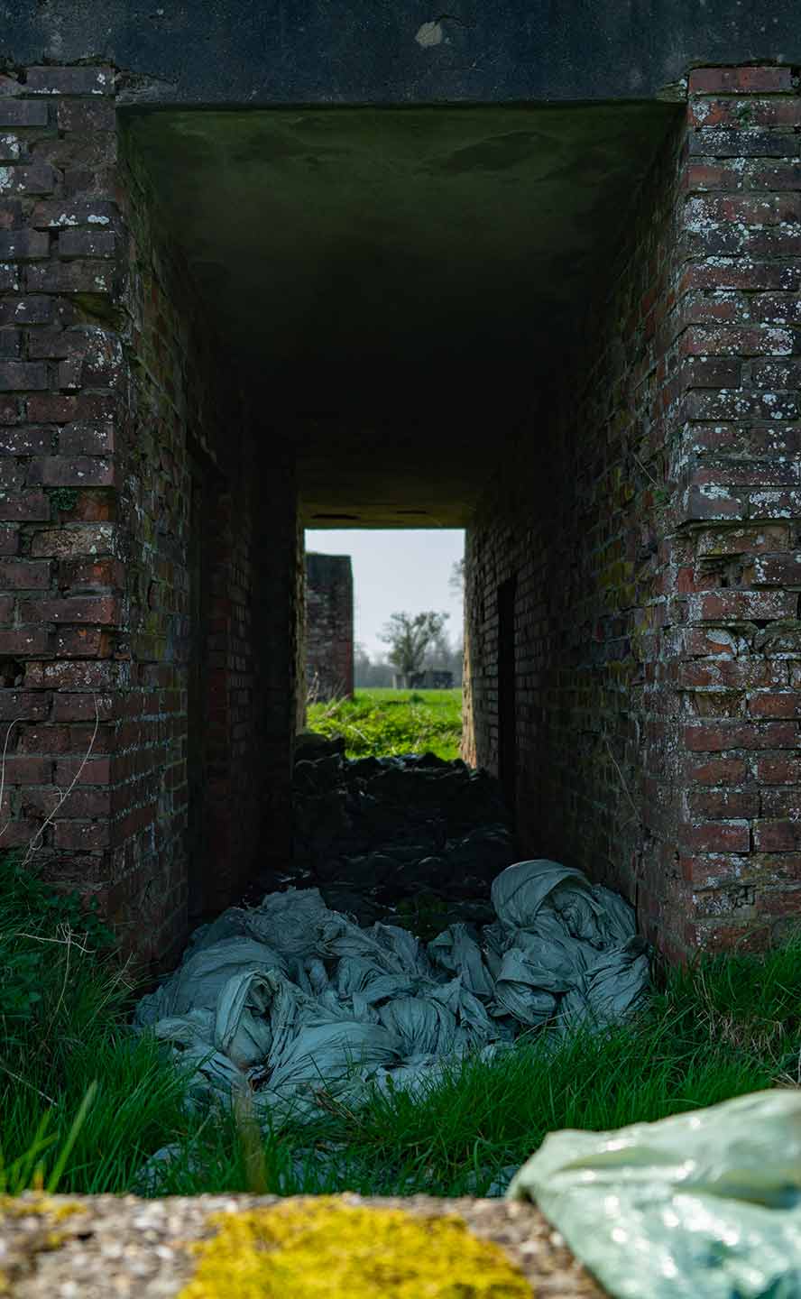
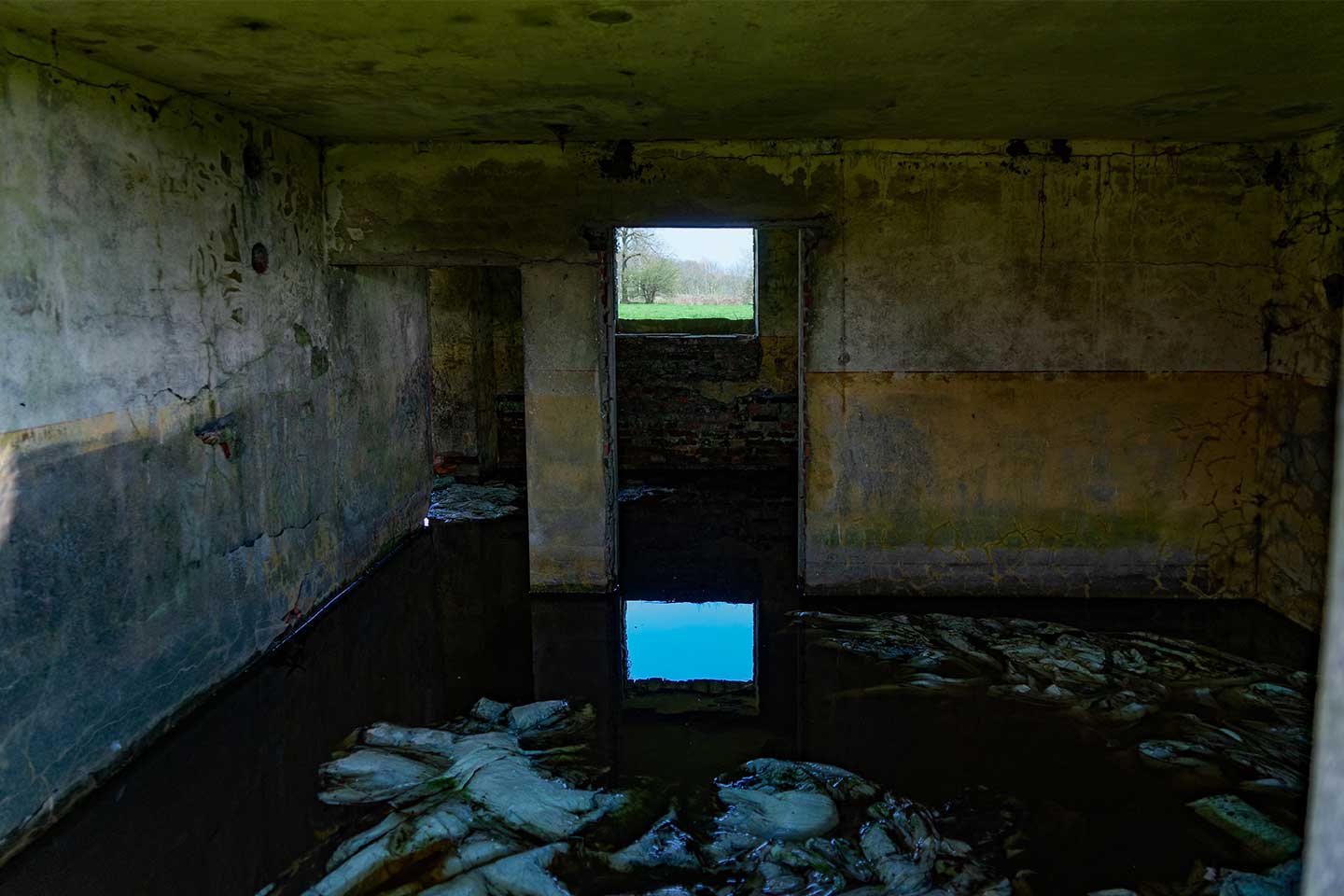
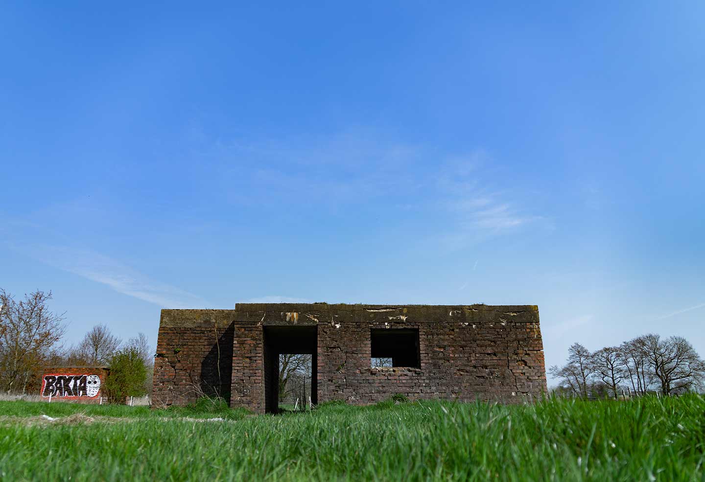
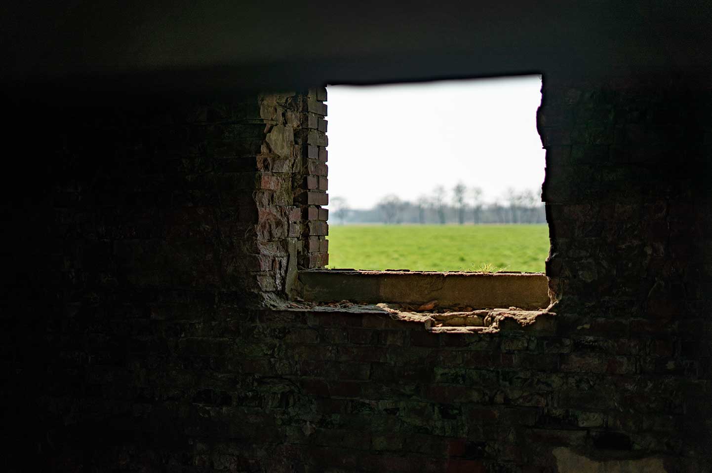
Most of the bunkers were filled with water. In the photo below you can see that the whole floor of the bunker is covered with water. Besides water, the floors of some bunkers were covered with plastic. I don’t know if the plastic is there for a reason, but it seems more like someone just threw them away here.
On the other side of the highway, I might have seen another set of bunkers. I’ll definitely be exploring that location soon! So stay tuned for a possible part 2!
Suggestions?
Subscribe for more location logs in the future! If you have any suggestion, make sure to leave them in the comments below! Meanwhile, you can visit some of the other location logs if you’d like.
Snelweg naar een nieuwe foto locatie
Dus je bent op zoek naar een urban exploring locatie in het noorden van Nederland? Jammer genoeg zijn er niet veel urbex locaties bekend hier. Maar ik heb wel een aantal verlaten bunkers kunnen vinden.
Op een dag was ik aan het rijden over de snelweg tussen Marum en Drachten, toen ik ineens een aantal kleine gebouwen in een weiland zag staan rechts van mij. Bedekt door bomen, leken het op bunkers. De volgende dag pakte ik mijn tas in met mijn camera spullen, stapte op mijn fiets, en ging richting de locatie.
Op de kaart hieronder kun je zien dat het eigenlijk heel dichtbij de snelweg was.
Bunkers
De reis naar de locatie was best een leuke tocht, met een rustige en vredige omgeving. De bunkers stonden naast een smal pad met een doodlopend einde. Het pad stopte net voor de bunkers.
Overal rond de bunkers waren kilometers platteland. Het enigste wat tussen mij en de bunkers stond, was een hek van prikkeldraad dat eindigde bij een boerderijhek dat op slot zat. Nou, als er niks meer is dan een boerderijhek wat mij tegenhoudt om bij de bunkers te komen, vraag je er gewoon om dat ik er overheen klim. Dus dat is wat ik deed, Hahaha.
Een korte geschiedenis
Deze bunkers zijn ruïnes van een oud Duits radarstation genaamd “Anlage Löwe”, gebouwd tijdens de Tweede Wereldoorlog. Deze bunkers staan ook wel bekend als de “Bunkers bij Trimunt”. In het midden van het veld staat nog het oude fundament van waar de radar heeft gestaan (zie de foto hieronder). Deze radar stond bekend als een “Würzburg-Riese radar”.
Dit radarstation was een deel van de “Himmelbett stellung”, welke het luchtruim bewaakte van West-Europa.
Rond de basis, waar de radar heeft gestaan, zijn nog overblijfselen van Tobruks. Op het moment had ik geen idee wat deze dingen waren. Ze leken op kleine opgeblazen bunkers en dat iemand het idee had om er bomen in te planten. Deze kleine bunkers werden gebruikt als uitkijkposten, vaak uitgerust met een machinegeweer. In de foto hieronder kun je één van de drie Tobruks zien die rond de radar stonden.
Mijn fotografie tocht rond de bunkers
Zoals je kunt zien in de foto hieronder, was de lucht echt prachtig toen ik de foto’s nam op het platteland. Wat je misschien ook kunt zien, is dat ik de foto vanaf het dak van een andere bunker heb gemaakt. De bunkers waren gedeeltelijk in de grond gezakt. Dus, met een beetje moeite, kon je er bovenop klimmen. Alleen, toen ik probeerde boven op één te klimmen, heb ik heel misschien mijn broek gescheurd van knie tot kruis. Na het schieten van de foto’s bij de bunkers wilde ik ook nog op een andere locatie nog wat foto’s maken, maar ik moest dit nu alleen wel doen met een gescheurde broek. Maar hey, dat is tegenwoordig mode toch? XD
In de foto hieronder kun je zien dat de hele vloer van de bunker bedekt was met water. Naast het water, waren de vloeren van sommige bunkers ook bedekt met plastic. Ik weet niet of het plastic daar met een reden lag, maar het leek er meer op dat iemand ze heeft weggegooid in de bunkers.
Aan de andere kant van de snelweg had ik ook nog een andere set bunkers gezien. Ik ga daar zeker binnenkort nog eens langs om die locatie te bezoeken! Dus je kunt dan zeker een deel 2 verwachten.
Suggesties?
Subscribe voor meer location logs in de toekomst! Als je nog suggesties hebt, laat het me dan weten via de comments hieronder! In de tussentijd kun je één van de andere location logs lezen als je wil.


